 vesseltracker.com
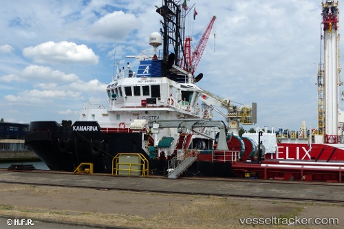
 Kamarina
Current Status
Where is the vessel?
Kamarina is currently in Near Kvaleberg, based on AIS data received about 1h ago.
Latest AIS update:
Current position: 59.02433° N, 5.61747° E (Near Kvaleberg)
Average speed (last 7 days): Loading…
Average speed (last 30 days): Loading…
Vessel profile: Kamarina is a Tug with dimensions 50m x 15m.
This page combines live AIS, route history, probable destination signals, nearby traffic, and port activity for practical vessel monitoring.
The current position of vessel Kamarina is 59.02433 lat / 5.61747 lng. Updated: 2026-04-10 00:16:39 UTCNearest reference points:
- Near Lura
- Near HUSOYA
- Near Storøya
Currently sailing under the flag of Italy ![]()
Kamarina built in 2010 year
Deadweight:
1268 tDetails:
Live Vessel Kamarina Analytics (details, animations, etc.)
Recent AIS points (UTC):
2026-04-09 17:40:39 UTC · 59.02437, 5.61745 · SOG 0 kn · COG 307°2026-04-09 20:04:37 UTC · 59.02438, 5.61750 · SOG 0 kn · COG 305°
2026-04-09 21:58:41 UTC · 59.02432, 5.61753 · SOG 0 kn · COG 308°
2026-04-10 00:16:39 UTC · 59.02433, 5.61747 · SOG 0 kn · COG 307°