 vesseltracker.com
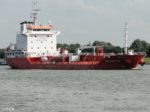
 Mary A
Current Status
Where is the vessel?
Mary A is currently in Near BRIELLE, based on AIS data received about 1h ago.
Latest AIS update:
Current position: 51.92193° N, 4.19453° E (Near BRIELLE)
Average speed (last 7 days): Loading…
Average speed (last 30 days): Loading…
Vessel profile: Mary A is a Chemical Oil Products Tanker with dimensions 113m x 113m.
This page combines live AIS, route history, probable destination signals, nearby traffic, and port activity for practical vessel monitoring.
The current position of vessel Mary A is 51.92193 lat / 4.19453 lng. Updated: 2026-04-16 21:56:22 UTCNearest reference points:
- Near BRIELLE
- Near Maassluis
- Near Zwartewaal
Currently sailing under the flag of Italy ![]()
Mary A built in 2007 year
Deadweight:
8084 tDetails:
Live Vessel Mary A Analytics (details, animations, etc.)
Recent AIS points (UTC):
2026-04-16 13:20:44 UTC · 51.92194, 4.19455 · SOG 0 kn · COG 40°2026-04-16 16:17:22 UTC · 51.92197, 4.19459 · SOG 0 kn · COG 40°
2026-04-16 20:17:23 UTC · 51.92192, 4.19456 · SOG 0 kn · COG 40°
2026-04-16 21:56:22 UTC · 51.92193, 4.19453 · SOG 0 kn · COG 40°