 vesseltracker.com
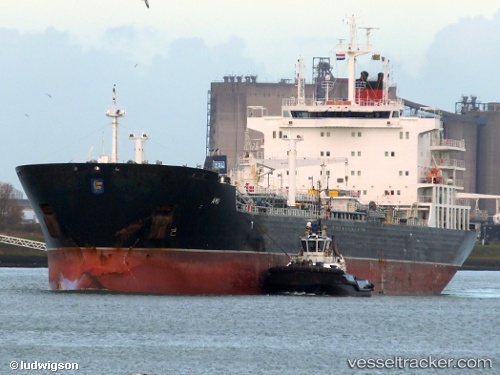
 LADY RINA
Current Status
Where is the vessel?
LADY RINA is currently in Near Jorf Lasfar, based on AIS data received about 2h ago.
Latest AIS update:
Current position: 33.12789° N, 8.68610° W (Near Jorf Lasfar)
Average speed (last 7 days): Loading…
Average speed (last 30 days): Loading…
Vessel profile: LADY RINA is a Chemical/Oil Products Tanker with dimensions 183m x 27m.
This page combines live AIS, route history, probable destination signals, nearby traffic, and port activity for practical vessel monitoring.
The current position of vessel LADY RINA is 33.12789 lat / -8.68610 lng. Updated: 2026-03-26 05:39:56 UTCNearest reference points:
- Near Jorf Lasfar
- 21 nm NW of El Jadida
- 44 nm NW of El Jadida
Currently sailing under the flag of Italy ![]()
LADY RINA built in 2012 year
Deadweight:
39310 tDetails:
Live Vessel LADY RINA Analytics (details, animations, etc.)
Recent AIS points (UTC):
2026-03-26 00:10:02 UTC · 33.17739, -8.66930 · SOG 0.1 kn · COG 20°2026-03-26 01:51:59 UTC · 33.17743, -8.66934 · SOG 0.1 kn · COG 23°
2026-03-26 03:27:59 UTC · 33.17722, -8.66881 · SOG 0.2 kn · COG 6°
2026-03-26 05:39:56 UTC · 33.12789, -8.68610 · SOG 3.9 kn · COG 125°