 vesseltracker.com
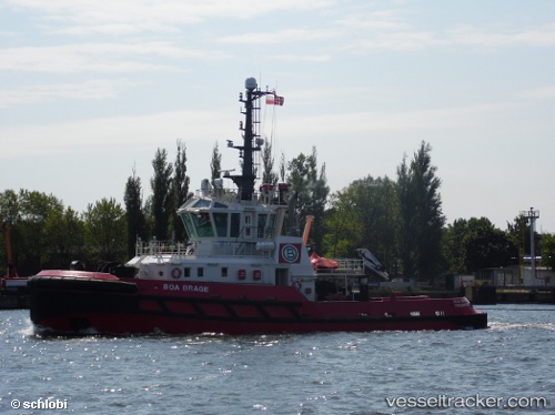
 BOA BRAGE
Current Status
Where is the vessel?
BOA BRAGE is currently in Near Sarköy, based on AIS data received about 1h ago.
Latest AIS update:
Current position: 40.51249° N, 27.02655° E (Near Sarköy)
Average speed (last 7 days): Loading…
Average speed (last 30 days): Loading…
Vessel profile: BOA BRAGE is a Tug with dimensions m x m.
This page combines live AIS, route history, probable destination signals, nearby traffic, and port activity for practical vessel monitoring.
The current position of vessel BOA BRAGE is 40.51249 lat / 27.02655 lng. Updated: 2026-03-27 05:32:41 UTCNearest reference points:
- Near Sarköy
- Near Marmara Adasi
- Near Gelibolu
Currently sailing under the flag of Malta ![]()
Details:
Live Vessel BOA BRAGE Analytics (details, animations, etc.)
Recent AIS points (UTC):
2026-03-26 23:22:45 UTC · 39.82709, 25.84874 · SOG 10 kn · COG 29°2026-03-27 01:37:04 UTC · 40.02078, 26.19868 · SOG 9.7 kn · COG 76°
2026-03-27 03:35:36 UTC · 40.29137, 26.57709 · SOG 13.7 kn · COG 50°
2026-03-27 05:32:41 UTC · 40.51249, 27.02655 · SOG 13.5 kn · COG 68°