 vesseltracker.com
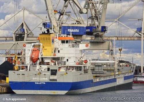
 GAGLIARDA
Current Status
Where is the vessel?
GAGLIARDA is currently in 41 nm NE of Habana, based on AIS data received about 1d ago.
Latest AIS update:
Current position: 23.68008° N, 81.89383° W (41 nm NE of Habana)
Average speed (last 7 days): Loading…
Average speed (last 30 days): Loading…
Vessel profile: GAGLIARDA is a General Cargo with dimensions m x m.
This page combines live AIS, route history, probable destination signals, nearby traffic, and port activity for practical vessel monitoring.
The current position of vessel GAGLIARDA is 23.68008 lat / -81.89383 lng. Updated: 2026-04-10 07:17:13 UTCNearest reference points:
- Near ALAMEDA DEL SIBONEY
- 40 nm S of Florida Straits
- Near Key West
Currently sailing under the flag of Malta ![]()
Details:
Live Vessel GAGLIARDA Analytics (details, animations, etc.)
Recent AIS points (UTC):
2026-04-10 02:12:19 UTC · 23.63909, -83.18580 · SOG 14.7 kn · COG -1°2026-04-10 04:12:39 UTC · 23.64760, -82.66072 · SOG 13.9 kn · COG -1°
2026-04-10 06:05:23 UTC · 23.66969, -82.20297 · SOG 13.8 kn · COG -1°
2026-04-10 07:17:13 UTC · 23.68008, -81.89383 · SOG 14.6 kn · COG 82°