 vesseltracker.com
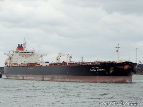
 Mt Semeru
Current Status
Where is the vessel?
Mt Semeru is currently in 123 nm E of Port Raysut, based on AIS data received about 15h ago.
Latest AIS update:
Current position: 16.23667° N, 56.03333° E (123 nm E of Port Raysut)
Average speed (last 7 days): Loading…
Average speed (last 30 days): Loading…
Vessel profile: Mt Semeru is a Crude Oil Tanker with dimensions 244m x 42m.
This page combines live AIS, route history, probable destination signals, nearby traffic, and port activity for practical vessel monitoring.
The current position of vessel Mt Semeru is 16.23667 lat / 56.03333 lng. Updated: 2026-04-12 05:16:05 UTCNearest reference points:
- 91 nm S of Pizhou
- 103 nm S of Port Raysut
- 39 nm SE of Pizhou
Currently sailing under the flag of Malta ![]()
Mt Semeru built in 2008 year
Deadweight:
105746 tDetails:
Live Vessel Mt Semeru Analytics (details, animations, etc.)
Recent AIS points (UTC):
2026-04-10 07:34:57 UTC · 19.02805, 65.22025 · SOG 13.5 kn · COG 277°2026-04-12 05:16:05 UTC · 16.23667, 56.03333 · SOG 12 kn · COG -1°
2026-04-12 05:16:05 UTC · 16.23667, 56.03333 · SOG 12 kn · COG -1°
2026-04-12 05:16:05 UTC · 16.23667, 56.03333 · SOG 12 kn · COG -1°