 vesseltracker.com
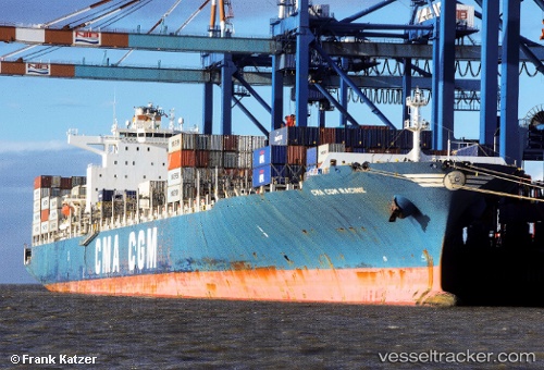
 Cma Cgm Racine
Current Status
Where is the vessel?
Cma Cgm Racine is currently in 40 nm E of YEONPYEONG, based on AIS data received less than 1h ago.
Latest AIS update:
Current position: 33.40955° N, 127.73122° E (40 nm E of YEONPYEONG)
Average speed (last 7 days): Loading…
Average speed (last 30 days): Loading…
Vessel profile: Cma Cgm Racine is a Container Ship with dimensions 300m x 300m.
This page combines live AIS, route history, probable destination signals, nearby traffic, and port activity for practical vessel monitoring.
The current position of vessel Cma Cgm Racine is 33.40955 lat / 127.73122 lng. Updated: 2026-04-01 18:08:38 UTCNearest reference points:
- 10 nm E of Seongsan-po
- 12 nm E of Geomundo
- 35 nm E of Geomundo
Currently sailing under the flag of Malta ![]()
Cma Cgm Racine built in 2010 year
Deadweight:
83216 tDetails:
Live Vessel Cma Cgm Racine Analytics (details, animations, etc.)
Recent AIS points (UTC):
2026-04-01 11:40:49 UTC · 33.51942, 127.57668 · SOG 0.6 kn · COG -1°2026-04-01 14:21:03 UTC · 33.49230, 127.61028 · SOG 1.2 kn · COG -1°
2026-04-01 15:41:11 UTC · 33.47227, 127.64598 · SOG 2 kn · COG -1°
2026-04-01 18:08:38 UTC · 33.40955, 127.73122 · SOG 2.4 kn · COG 48°