 vesseltracker.com
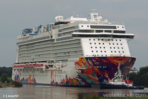
 AROYA
AROYA
Current Status
Where is the vessel?
AROYA is currently in Near Ad Dammam, based on AIS data received less than 1h ago.
Latest AIS update:
Current position: 26.48795° N, 50.20456° E (Near Ad Dammam)
Average speed (last 7 days): Loading…
Average speed (last 30 days): Loading…
Vessel profile: AROYA is a Passenger with dimensions m x m.
This page combines live AIS, route history, probable destination signals, nearby traffic, and port activity for practical vessel monitoring.
The current position of vessel AROYA is 26.48795 lat / 50.20456 lng. Updated: 2026-04-12 22:11:31 UTCNearest reference points:
- Near Ad Dammam
- Near DAMMAM
- Near Sayhat
Currently sailing under the flag of Malta ![]()
Details:
Live Vessel AROYA Analytics (details, animations, etc.)
Recent AIS points (UTC):
2026-04-12 15:32:35 UTC · 26.48795, 50.20455 · SOG 0 kn · COG 192°2026-04-12 17:56:35 UTC · 26.48795, 50.20455 · SOG 0 kn · COG 192°
2026-04-12 19:38:34 UTC · 26.48795, 50.20456 · SOG 0 kn · COG 192°
2026-04-12 22:11:31 UTC · 26.48795, 50.20456 · SOG 0 kn · COG 192°