 vesseltracker.com
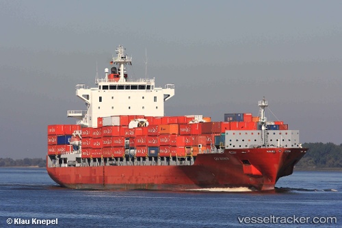
 DELOS WAVE
Current Status
Where is the vessel?
DELOS WAVE is currently in 43 nm SE of Cheviot, based on AIS data received about 1h ago.
Latest AIS update:
Current position: 43.40852° S, 173.80719° E (43 nm SE of Cheviot)
Average speed (last 7 days): Loading…
Average speed (last 30 days): Loading…
Vessel profile: DELOS WAVE is a Container Ship with dimensions m x m.
This page combines live AIS, route history, probable destination signals, nearby traffic, and port activity for practical vessel monitoring.
The current position of vessel DELOS WAVE is -43.40852 lat / 173.80719 lng. Updated: 2026-04-18 17:49:34 UTCNearest reference points:
- Near Renwick
- Near WAIKAWA
- Near Nelson
Currently sailing under the flag of Malta ![]()
Details:
Live Vessel DELOS WAVE Analytics (details, animations, etc.)
Recent AIS points (UTC):
2026-04-18 11:25:49 UTC · -44.47039, 172.44460 · SOG 13.3 kn · COG 45°2026-04-18 13:23:05 UTC · -44.14774, 172.87315 · SOG 13.6 kn · COG 46°
2026-04-18 15:33:52 UTC · -43.79620, 173.34383 · SOG 13.4 kn · COG 44°
2026-04-18 17:49:34 UTC · -43.40852, 173.80719 · SOG 13.7 kn · COG 42°