 vesseltracker.com
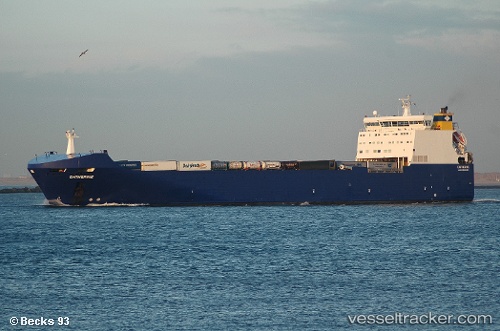
 Catherine
Current Status
Where is the vessel?
Catherine is currently in Near Zwartewaal, based on AIS data received about 1h ago.
Latest AIS update:
Current position: 51.89774° N, 4.23191° E (Near Zwartewaal)
Average speed (last 7 days): Loading…
Average speed (last 30 days): Loading…
Vessel profile: Catherine is a Ro Ro Cargo Ship with dimensions 182m x 26m.
This page combines live AIS, route history, probable destination signals, nearby traffic, and port activity for practical vessel monitoring.
The current position of vessel Catherine is 51.89774 lat / 4.23191 lng. Updated: 2026-03-29 21:37:24 UTCNearest reference points:
- Near Zwartewaal
- Near Maassluis
- Near Botlek
Currently sailing under the flag of Malta ![]()
Catherine built in 2002 year
Deadweight:
13320 tDetails:
Live Vessel Catherine Analytics (details, animations, etc.)
Recent AIS points (UTC):
2026-03-29 16:16:23 UTC · 51.89775, 4.23207 · SOG 0 kn · COG 323°2026-03-29 18:22:20 UTC · 51.89771, 4.23191 · SOG 0 kn · COG 323°
2026-03-29 20:10:23 UTC · 51.89769, 4.23196 · SOG 0 kn · COG 323°
2026-03-29 21:37:24 UTC · 51.89774, 4.23191 · SOG 0 kn · COG 323°