 vesseltracker.com
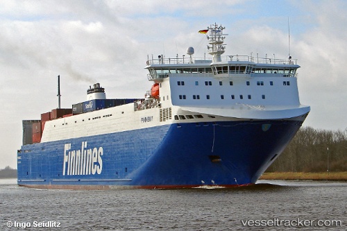
 EUROCARGO TRIESTE
Current Status
Where is the vessel?
EUROCARGO TRIESTE is currently in 10 nm E of Marina di Monasterace, based on AIS data received about 1h ago.
Latest AIS update:
Current position: 38.41320° N, 16.78805° E (10 nm E of Marina di Monasterace)
Average speed (last 7 days): Loading…
Average speed (last 30 days): Loading…
Vessel profile: EUROCARGO TRIESTE is a Ro-Ro Cargo with dimensions m x m.
This page combines live AIS, route history, probable destination signals, nearby traffic, and port activity for practical vessel monitoring.
The current position of vessel EUROCARGO TRIESTE is 38.41320 lat / 16.78805 lng. Updated: 2026-04-10 03:48:35 UTCNearest reference points:
- Near Pizzo
- Near CROTONE
- 24 nm SE of Bianco
Currently sailing under the flag of Malta ![]()
Details:
Live Vessel EUROCARGO TRIESTE Analytics (details, animations, etc.)
Recent AIS points (UTC):
2026-04-09 22:00:20 UTC · 39.75487, 18.41580 · SOG 19.5 kn · COG 220°2026-04-10 00:18:23 UTC · 39.22731, 17.77322 · SOG 18.6 kn · COG 222°
2026-04-10 02:28:05 UTC · 38.72948, 17.16789 · SOG 19.1 kn · COG 224°
2026-04-10 03:48:35 UTC · 38.41320, 16.78805 · SOG 19.1 kn · COG 220°