 vesseltracker.com
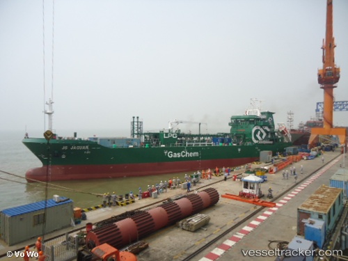
 CGAS JAGUAR
Current Status
Where is the vessel?
CGAS JAGUAR is currently in Near TEES, based on AIS data received about 1h ago.
Latest AIS update:
Current position: 54.62252° N, 1.16413° W (Near TEES)
Average speed (last 7 days): Loading…
Average speed (last 30 days): Loading…
Vessel profile: CGAS JAGUAR is a Lpg Tanker with dimensions m x m.
This page combines live AIS, route history, probable destination signals, nearby traffic, and port activity for practical vessel monitoring.
The current position of vessel CGAS JAGUAR is 54.62252 lat / -1.16413 lng. Updated: 2026-04-22 07:55:11 UTCNearest reference points:
- Near TYNE
- Near Blyth
- Near Hessle/Hull
Currently sailing under the flag of Malta ![]()
Details:
Live Vessel CGAS JAGUAR Analytics (details, animations, etc.)
Recent AIS points (UTC):
2026-04-22 04:57:28 UTC · 54.62253, -1.16415 · SOG 0.1 kn · COG 30°2026-04-22 06:21:28 UTC · 54.62251, -1.16413 · SOG 0 kn · COG 30°
2026-04-22 07:21:27 UTC · 54.62252, -1.16413 · SOG 0.1 kn · COG 31°
2026-04-22 07:55:11 UTC · 54.62252, -1.16413 · SOG 0.1 kn · COG 31°