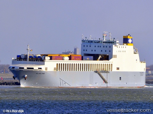
 Wilhelmine
Current Status
Where is the vessel?
Wilhelmine is currently in Near ERITH, based on AIS data received about 15h ago.
Latest AIS update:
Current position: 51.51184° N, 0.15272° E (Near ERITH)
Average speed (last 7 days): Loading…
Average speed (last 30 days): Loading…
Vessel profile: Wilhelmine is a Ro Ro Cargo Ship with dimensions 152m x 24m.
This page combines live AIS, route history, probable destination signals, nearby traffic, and port activity for practical vessel monitoring.
The current position of vessel Wilhelmine is 51.51184 lat / 0.15272 lng. Updated: 2026-05-23 10:21:05 UTCNearest reference points:
- Near Blackheath/London
- Near Gravesend
- Near GILLINGHAM
Currently sailing under the flag of Malta ![]()
Wilhelmine built in 2012 year
Deadweight:
6374 tDetails:
Live Vessel Wilhelmine Analytics (details, animations, etc.)
Recent AIS points (UTC):
2026-05-23 07:39:09 UTC · 51.51183, 0.15274 · SOG 0 kn · COG 287°2026-05-23 08:00:08 UTC · 51.51183, 0.15270 · SOG 0 kn · COG 287°
2026-05-23 10:21:05 UTC · 51.51184, 0.15272 · SOG 0 kn · COG 287°
2026-05-23 10:21:05 UTC · 51.51184, 0.15272 · SOG 0 kn · COG 287°