 vesseltracker.com
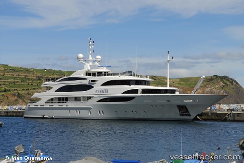
 HALCYON
Current Status
Where is the vessel?
HALCYON is currently in Near ST THOMAS, based on AIS data received less than 1h ago.
Latest AIS update:
Current position: 18.33434° N, 64.92945° W (Near ST THOMAS)
Average speed (last 7 days): Loading…
Average speed (last 30 days): Loading…
Vessel profile: HALCYON is a Yacht with dimensions m x m.
This page combines live AIS, route history, probable destination signals, nearby traffic, and port activity for practical vessel monitoring.
The current position of vessel HALCYON is 18.33434 lat / -64.92945 lng. Updated: 2026-04-18 06:22:17 UTCNearest reference points:
- Near ST THOMAS
- Near Charlotte Amalie
- Near Norman Island
Currently sailing under the flag of Malta ![]()
Details:
Live Vessel HALCYON Analytics (details, animations, etc.)
Recent AIS points (UTC):
2026-04-18 00:20:24 UTC · 18.33441, -64.92945 · SOG 0.2 kn · COG -1°2026-04-18 01:55:09 UTC · 18.33435, -64.92950 · SOG 0.2 kn · COG -1°
2026-04-18 03:37:57 UTC · 18.33434, -64.92949 · SOG 0.1 kn · COG -1°
2026-04-18 06:22:17 UTC · 18.33434, -64.92945 · SOG 0.1 kn · COG -1°