 vesseltracker.com
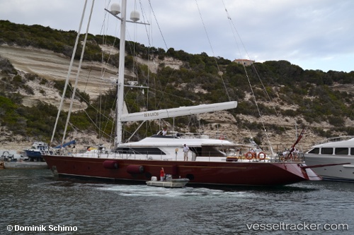
 MARE NOSTRUM
Current Status
Where is the vessel?
MARE NOSTRUM is currently in Near Roquebrune-Cap-Martin, based on AIS data received about 2h ago.
Latest AIS update:
Current position: 43.75145° N, 7.46897° E (Near Roquebrune-Cap-Martin)
Average speed (last 7 days): Loading…
Average speed (last 30 days): Loading…
Vessel profile: MARE NOSTRUM is a Sailing with dimensions m x m.
This page combines live AIS, route history, probable destination signals, nearby traffic, and port activity for practical vessel monitoring.
The current position of vessel MARE NOSTRUM is 43.75145 lat / 7.46897 lng. Updated: 2026-04-13 11:50:09 UTCNearest reference points:
- Near Monaco
- Near Monte-Carlo
- Near SAINTJEAN CAP FERRAT
Currently sailing under the flag of Malta ![]()
Details:
Live Vessel MARE NOSTRUM Analytics (details, animations, etc.)
Recent AIS points (UTC):
2026-04-13 05:42:21 UTC · 43.69584, 7.32083 · SOG 1.1 kn · COG 291°2026-04-13 08:18:55 UTC · 43.69577, 7.32033 · SOG 0.4 kn · COG 15°
2026-04-13 09:52:49 UTC · 43.75140, 7.46918 · SOG 1.2 kn · COG 353°
2026-04-13 11:50:09 UTC · 43.75145, 7.46897 · SOG 0.2 kn · COG 16°