 vesseltracker.com
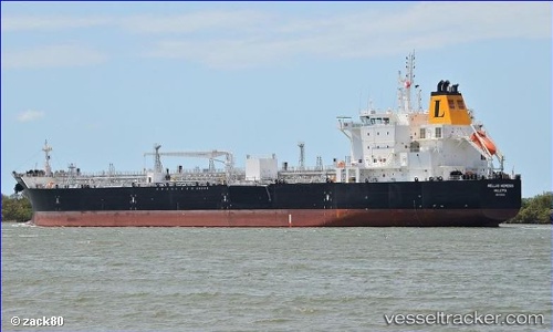
 Hellas Nemesis
Current Status
Where is the vessel?
Hellas Nemesis is currently in 178 nm S of Mul Dwårka, based on AIS data received about 1h ago.
Latest AIS update:
Current position: 17.98539° N, 69.52383° E (178 nm S of Mul Dwårka)
Average speed (last 7 days): Loading…
Average speed (last 30 days): Loading…
Vessel profile: Hellas Nemesis is a Chemical Oil Products Tanker with dimensions 183m x 183m.
This page combines live AIS, route history, probable destination signals, nearby traffic, and port activity for practical vessel monitoring.
The current position of vessel Hellas Nemesis is 17.98539 lat / 69.52383 lng. Updated: 2026-04-13 13:47:51 UTCNearest reference points:
- 236 nm SW of Veraval
- 282 nm W of RATNAGIRI
- 306 nm SW of Veraval
Currently sailing under the flag of Malta ![]()
Details:
Live Vessel Hellas Nemesis Analytics (details, animations, etc.)
Recent AIS points (UTC):
2026-04-13 08:14:31 UTC · 18.01582, 69.51980 · SOG 0.3 kn · COG 245°2026-04-13 09:33:30 UTC · 18.00692, 69.52127 · SOG 0.2 kn · COG 242°
2026-04-13 12:19:50 UTC · 17.99220, 69.52450 · SOG 0.4 kn · COG 259°
2026-04-13 13:47:51 UTC · 17.98539, 69.52383 · SOG 0.3 kn · COG 256°