 vesseltracker.com
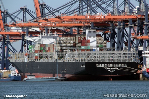
Cape Kortia
Current StatusWhere is the vessel?
Cape Kortia is currently in 66 nm SW of Nosara Beach, based on AIS data received less than 1h ago.
Latest AIS update:
Current position: 9.03284° N, 86.25369° W (66 nm SW of Nosara Beach)
Average speed (last 7 days): Loading…
Average speed (last 30 days): Loading…
Vessel profile: Cape Kortia is a Container Ship with dimensions 48m x 330m.
This page combines live AIS, route history, probable destination signals, nearby traffic, and port activity for practical vessel monitoring.
The current position of vessel Cape Kortia is 9.03284 lat / -86.25369 lng. Updated: 2026-04-12 21:56:57 UTCNearest reference points:
- 67 nm SW of Sámara
- 27 nm W of Playa Conchal
- Near Golfo de Papagayo
Details:
Live Vessel Cape Kortia Analytics (details, animations, etc.)
Recent AIS points (UTC):
2026-04-12 16:22:20 UTC · 9.44297, -87.09877 · SOG 9 kn · COG 111°2026-04-12 18:10:00 UTC · 9.31950, -86.84622 · SOG 9.8 kn · COG 113°
2026-04-12 19:47:21 UTC · 9.20309, -86.60009 · SOG 9.8 kn · COG 118°
2026-04-12 21:56:57 UTC · 9.03284, -86.25369 · SOG 11.2 kn · COG 116°