 vesseltracker.com
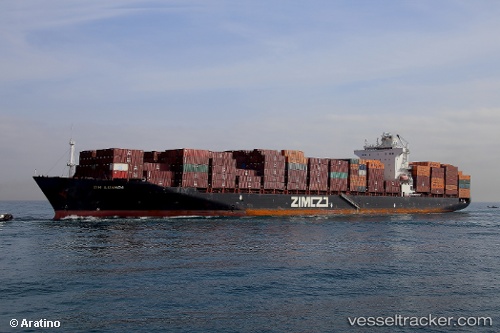
Vessel Zim Luanda IMO: 9403229, MMSI: 249830000 Container Ship
UTC, 31.85671, 34.63132, course: 121, speed: 6
UTC, 31.83167, 34.64667, course: -1, speed: 0
2026-03-02 23:28:41 UTC, 31.83167, 34.64667, course: -1, speed: 0
Live AIS position:
UTC. Near Ashdod Bonded),
updated 2026-03-02 23:28:41 UTC.
Find the position of the vessel Zim Luanda on the map. The latter are known coordinates and path.
marine traffic ship tracker show on live map
The current position of vessel Zim Luanda is 31.83167 lat / 34.64667 lng. Updated: 2026-03-02 23:28:41 UTCDetails:
Last coordinates of the vessel:
UTC, 31.90447, 34.47635, course: 97, speed: 4.7UTC, 31.85671, 34.63132, course: 121, speed: 6
UTC, 31.83167, 34.64667, course: -1, speed: 0
2026-03-02 23:28:41 UTC, 31.83167, 34.64667, course: -1, speed: 0