 vesseltracker.com
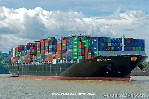
 Cape Tainaro
Current Status
Where is the vessel?
Cape Tainaro is currently in 48 nm W of Petrolia, based on AIS data received about 1h ago.
Latest AIS update:
Current position: 40.21725° N, 125.33152° W (48 nm W of Petrolia)
Average speed (last 7 days): Loading…
Average speed (last 30 days): Loading…
Vessel profile: Cape Tainaro is a Container Ship with dimensions 330m x 48m.
This page combines live AIS, route history, probable destination signals, nearby traffic, and port activity for practical vessel monitoring.
The current position of vessel Cape Tainaro is 40.21725 lat / -125.33152 lng. Updated: 2026-04-08 13:37:05 UTCNearest reference points:
- Near Little River
- Near Bodega Bay
Currently sailing under the flag of Malta ![]()
Details:
Live Vessel Cape Tainaro Analytics (details, animations, etc.)
Recent AIS points (UTC):
2026-04-08 07:52:14 UTC · 40.29881, -125.27841 · SOG 0.8 kn · COG 137°2026-04-08 10:11:03 UTC · 40.26089, -125.29286 · SOG 0.7 kn · COG 126°
2026-04-08 12:05:05 UTC · 40.23282, -125.30860 · SOG 1.3 kn · COG 116°
2026-04-08 13:37:05 UTC · 40.21725, -125.33152 · SOG 0.5 kn · COG 130°