 vesseltracker.com
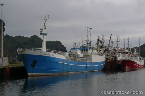
Kap Ii
Current StatusWhere is the vessel?
Kap Ii is currently in 18 nm W of VESTMANNAEYJAR, based on AIS data received about 1d ago.
Latest AIS update:
Current position: 63.40559° N, 20.93695° W (18 nm W of VESTMANNAEYJAR)
Average speed (last 7 days): Loading…
Average speed (last 30 days): Loading…
Vessel profile: Kap Ii is a Fish Carrier with dimensions 8m x 50m.
This page combines live AIS, route history, probable destination signals, nearby traffic, and port activity for practical vessel monitoring.
The current position of vessel Kap Ii is 63.40559 lat / -20.93695 lng. Updated: 2026-04-10 08:18:11 UTCNearest reference points:
- Near HERJOLFUR
- Near Reykjavik
- Near HAFNARFJORDUR
Details:
Live Vessel Kap Ii Analytics (details, animations, etc.)
Recent AIS points (UTC):
2026-04-10 01:28:35 UTC · 63.44490, -20.27923 · SOG 0 kn · COG 90°2026-04-10 03:43:26 UTC · 63.44491, -20.27920 · SOG 0 kn · COG 89°
2026-04-10 06:20:47 UTC · 63.45142, -20.54926 · SOG 7.9 kn · COG 265°
2026-04-10 08:18:11 UTC · 63.40559, -20.93695 · SOG 1.2 kn · COG 237°