 vesseltracker.com
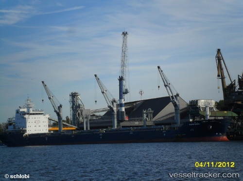
 BARBRO G
Current Status
Where is the vessel?
BARBRO G is currently in Near Bettioua, based on AIS data received about 1h ago.
Latest AIS update:
Current position: 35.81057° N, 0.17340° W (Near Bettioua)
Average speed (last 7 days): Loading…
Average speed (last 30 days): Loading…
Vessel profile: BARBRO G is a Bulk Carrier with dimensions 190m x 24m.
This page combines live AIS, route history, probable destination signals, nearby traffic, and port activity for practical vessel monitoring.
The current position of vessel BARBRO G is 35.81057 lat / -0.17340 lng. Updated: 2026-03-25 17:56:56 UTCNearest reference points:
- Near Arzew
- Near Mostaganem
- Near Oran
Currently sailing under the flag of Portugal (MAR) ![]()
BARBRO G built in 2010 year
Deadweight:
29975 tDetails:
Live Vessel BARBRO G Analytics (details, animations, etc.)
Recent AIS points (UTC):
2026-03-25 11:34:57 UTC · 35.81061, -0.17338 · SOG 0 kn · COG -1°2026-03-25 13:34:15 UTC · 35.81058, -0.17340 · SOG 0 kn · COG 14°
2026-03-25 16:08:09 UTC · 35.81073, -0.17342 · SOG 0 kn · COG -1°
2026-03-25 17:56:56 UTC · 35.81057, -0.17340 · SOG 0 kn · COG 14°