 vesseltracker.com
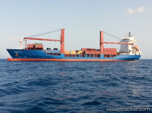
 Laura S
Current Status
Where is the vessel?
Laura S is currently in Near Las Palmas, based on AIS data received about 5d ago.
Latest AIS update:
Current position: 28.15538° N, 15.41197° W (Near Las Palmas)
Average speed (last 7 days): Loading…
Average speed (last 30 days): Loading…
Vessel profile: Laura S is a Container Ship with dimensions 120m x 21m.
This page combines live AIS, route history, probable destination signals, nearby traffic, and port activity for practical vessel monitoring.
The current position of vessel Laura S is 28.15538 lat / -15.41197 lng. Updated: 2026-04-08 07:26:01 UTCNearest reference points:
- Near Las Palmas
- Near Las Palmas de Gran Canaria
- Near TALIARTE
Currently sailing under the flag of Portugal ![]()
Laura S built in 1998 year
Deadweight:
6770 tDetails:
Live Vessel Laura S Analytics (details, animations, etc.)
Recent AIS points (UTC):
2026-04-08 06:26:26 UTC · 28.15539, -15.41196 · SOG 0 kn · COG 183°2026-04-08 07:26:01 UTC · 28.15538, -15.41197 · SOG 0 kn · COG -1°
2026-04-08 07:26:01 UTC · 28.15538, -15.41197 · SOG 0 kn · COG -1°
2026-04-08 07:26:01 UTC · 28.15538, -15.41197 · SOG 0 kn · COG -1°