 vesseltracker.com
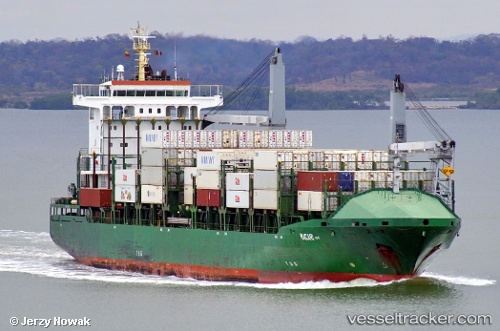
 CMA CGM VENTANIA
Current Status
Where is the vessel?
CMA CGM VENTANIA is currently in 42 nm SE of Lince, based on AIS data received about 1h ago.
Latest AIS update:
Current position: 11.62667° N, 76.52500° W (42 nm SE of Lince)
Average speed (last 7 days): Loading…
Average speed (last 30 days): Loading…
Vessel profile: CMA CGM VENTANIA is a Container Ship with dimensions 25m x 161m.
This page combines live AIS, route history, probable destination signals, nearby traffic, and port activity for practical vessel monitoring.
The current position of vessel CMA CGM VENTANIA is 11.62667 lat / -76.52500 lng. Updated: 2026-04-20 11:51:03 UTCNearest reference points:
- Near Sociedad Portuaria Regional Cartagena
- Near Contecar
- 62 nm NE of Playón Chico
Currently sailing under the flag of Portugal (MAR) ![]()
CMA CGM VENTANIA built in 2007 year
Deadweight:
17201 tDetails:
Live Vessel CMA CGM VENTANIA Analytics (details, animations, etc.)
Recent AIS points (UTC):
2026-04-20 08:11:27 UTC · 12.33667, -77.01500 · SOG 14 kn · COG -1°2026-04-20 09:35:40 UTC · 12.05833, -76.82833 · SOG 14 kn · COG -1°
2026-04-20 10:26:46 UTC · 11.89167, -76.71333 · SOG 14 kn · COG -1°
2026-04-20 11:51:03 UTC · 11.62667, -76.52500 · SOG 14 kn · COG -1°