 vesseltracker.com
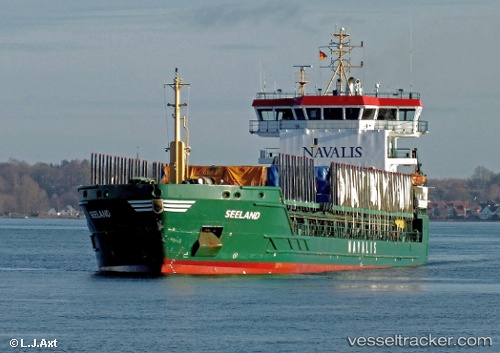
 SEELAND
Current Status
Where is the vessel?
SEELAND is currently in Near Lulea, based on AIS data received less than 1h ago.
Latest AIS update:
Current position: 65.52992° N, 22.33091° E (Near Lulea)
Average speed (last 7 days): Loading…
Average speed (last 30 days): Loading…
Vessel profile: SEELAND is a General Cargo Ship with dimensions 117m x 16m.
This page combines live AIS, route history, probable destination signals, nearby traffic, and port activity for practical vessel monitoring.
The current position of vessel SEELAND is 65.52992 lat / 22.33091 lng. Updated: 2026-04-13 16:07:11 UTCNearest reference points:
- Near Karlsborg Axelvik
- 20 nm S of HOLMSUND
Currently sailing under the flag of Portugal (MAR) ![]()
SEELAND built in 2006 year
Deadweight:
7064 tDetails:
Live Vessel SEELAND Analytics (details, animations, etc.)
Recent AIS points (UTC):
2026-04-13 10:01:43 UTC · 64.90569, 22.24924 · SOG 11 kn · COG 4°2026-04-13 12:13:39 UTC · 65.21218, 22.36016 · SOG 10.4 kn · COG 339°
2026-04-13 14:17:32 UTC · 65.35917, 22.33052 · SOG 0 kn · COG 3°
2026-04-13 16:07:11 UTC · 65.52992, 22.33091 · SOG 10.4 kn · COG 320°