 vesseltracker.com
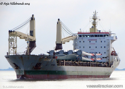
 CELINE C
Current Status
Where is the vessel?
CELINE C is currently in Near Calais, based on AIS data received about 2d ago.
Latest AIS update:
Current position: 51.04263° N, 1.88024° E (Near Calais)
Average speed (last 7 days): Loading…
Average speed (last 30 days): Loading…
Vessel profile: CELINE C is a General Cargo with dimensions m x m.
This page combines live AIS, route history, probable destination signals, nearby traffic, and port activity for practical vessel monitoring.
The current position of vessel CELINE C is 51.04263 lat / 1.88024 lng. Updated: 2026-04-09 21:02:12 UTCNearest reference points:
- Near Calais
- 14 nm SE of RAMSGATE
- Near Sangatte
Currently sailing under the flag of Portugal ![]()
Details:
Live Vessel CELINE C Analytics (details, animations, etc.)
Recent AIS points (UTC):
2026-04-08 07:56:35 UTC · 51.40717, 3.04393 · SOG 3.3 kn · COG 89°2026-04-09 21:02:12 UTC · 51.04263, 1.88024 · SOG 5.6 kn · COG 93°
2026-04-09 21:02:12 UTC · 51.04263, 1.88024 · SOG 5.6 kn · COG 93°
2026-04-09 21:02:12 UTC · 51.04263, 1.88024 · SOG 5.6 kn · COG 93°