 vesseltracker.com
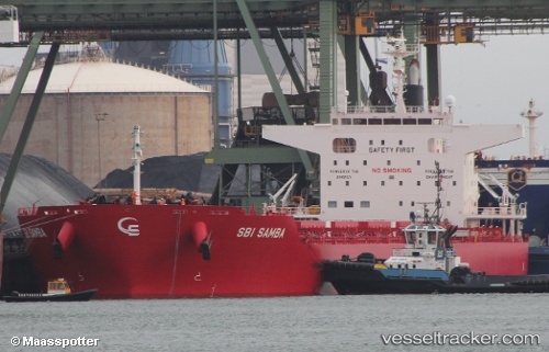
 S SAMBA
Current Status
Where is the vessel?
S SAMBA is currently in 113 nm E of Seica, based on AIS data received less than 1h ago.
Latest AIS update:
Current position: 39.53092° N, 47.64003° W (113 nm E of Seica)
Average speed (last 7 days): Loading…
Average speed (last 30 days): Loading…
Vessel profile: S SAMBA is a Cargo with dimensions m x m.
This page combines live AIS, route history, probable destination signals, nearby traffic, and port activity for practical vessel monitoring.
The current position of vessel S SAMBA is 39.53092 lat / -47.64003 lng. Updated: 2026-04-21 13:27:38 UTCCurrently sailing under the flag of Portugal ![]()
Details:
Live Vessel S SAMBA Analytics (details, animations, etc.)
Recent AIS points (UTC):
2026-04-21 09:51:23 UTC · 39.63170, -46.92009 · SOG 1.6 kn · COG 243°2026-04-21 11:45:43 UTC · 39.58233, -47.24415 · SOG 11 kn · COG 255°
2026-04-21 13:27:38 UTC · 39.53092, -47.64003 · SOG 11.1 kn · COG 256°
2026-04-21 13:27:38 UTC · 39.53092, -47.64003 · SOG 11.1 kn · COG 256°