 vesseltracker.com
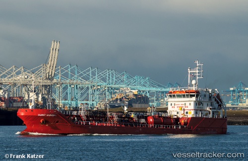
 FRECCIAMARE
Current Status
Where is the vessel?
FRECCIAMARE is currently in 19 nm S of Seaford, based on AIS data received about 1h ago.
Latest AIS update:
Current position: 50.46919° N, 0.05256° W (19 nm S of Seaford)
Average speed (last 7 days): Loading…
Average speed (last 30 days): Loading…
Vessel profile: FRECCIAMARE is a Oil/Chemical Tanker with dimensions m x m.
This page combines live AIS, route history, probable destination signals, nearby traffic, and port activity for practical vessel monitoring.
The current position of vessel FRECCIAMARE is 50.46919 lat / -0.05256 lng. Updated: 2026-03-30 17:29:49 UTCNearest reference points:
- 27 nm S of Seaford
- 23 nm S of Ferring
- 23 nm S of Poling
Currently sailing under the flag of Portugal ![]()
Details:
Live Vessel FRECCIAMARE Analytics (details, animations, etc.)
Recent AIS points (UTC):
2026-03-30 12:16:04 UTC · 50.83126, 1.12078 · SOG 8.6 kn · COG 234°2026-03-30 13:51:00 UTC · 50.69479, 0.79960 · SOG 9.5 kn · COG 237°
2026-03-30 15:31:00 UTC · 50.56317, 0.39412 · SOG 10.5 kn · COG 255°
2026-03-30 17:29:49 UTC · 50.46919, -0.05256 · SOG 7.8 kn · COG 239°