 vesseltracker.com
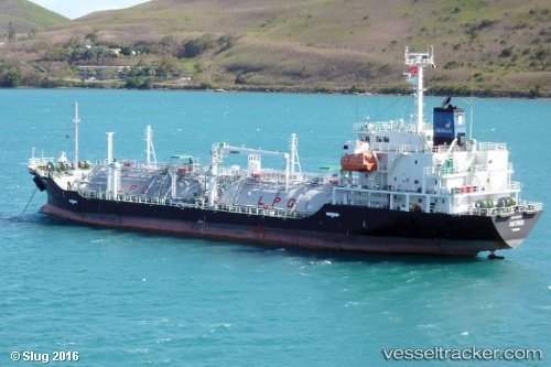
 GAS XANADU
Current Status
Where is the vessel?
GAS XANADU is currently in Near La Coruna , based on AIS data received about 1h ago.
Latest AIS update:
Current position: 43.35673° N, 8.38772° W (Near La Coruna )
Average speed (last 7 days): Loading…
Average speed (last 30 days): Loading…
Vessel profile: GAS XANADU is a Lpg Tanker with dimensions m x m.
This page combines live AIS, route history, probable destination signals, nearby traffic, and port activity for practical vessel monitoring.
The current position of vessel GAS XANADU is 43.35673 lat / -8.38772 lng. Updated: 2026-04-21 13:55:22 UTCNearest reference points:
- Near La Coruna
- Near PUNTA LANGOSTEIRA
- Near Ferrol
Currently sailing under the flag of Portugal ![]()
Details:
Live Vessel GAS XANADU Analytics (details, animations, etc.)
Recent AIS points (UTC):
2026-04-21 10:26:58 UTC · 43.38766, -8.24086 · SOG 0.2 kn · COG 179°2026-04-21 11:55:16 UTC · 43.37919, -8.36685 · SOG 7.7 kn · COG 184°
2026-04-21 13:52:20 UTC · 43.35674, -8.38772 · SOG 0 kn · COG 308°
2026-04-21 13:55:22 UTC · 43.35673, -8.38772 · SOG 0 kn · COG 308°