 vesseltracker.com
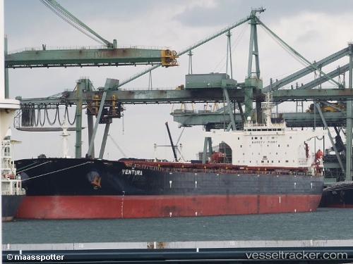
 Ventura
Current Status
Where is the vessel?
Ventura is currently in 64 nm W of Jeddah, based on AIS data received about 1145d ago.
Latest AIS update:
Current position: 21.30978° N, 38.01743° E (64 nm W of Jeddah)
Average speed (last 7 days): Loading…
Average speed (last 30 days): Loading…
Vessel profile: Ventura is a Bulk Carrier with dimensions 289m x 45m.
This page combines live AIS, route history, probable destination signals, nearby traffic, and port activity for practical vessel monitoring.
The current position of vessel Ventura is 21.30978 lat / 38.01743 lng. Updated: 2023-02-20 17:43:30 UTCNearest reference points:
- 64 nm W of Tusdeer Free Zone
- 67 nm W of Tusdeer Free Zone
- 65 nm SW of King Abdullah City
Currently sailing under the flag of Malta ![]()
Ventura built in 2006 year
Deadweight:
174316 tDetails:
Live Vessel Ventura Analytics (details, animations, etc.)
Recent AIS points (UTC):
2023-02-20 17:43:30 UTC · 21.30978, 38.01743 · SOG 0 kn · COG 0°