 vesseltracker.com
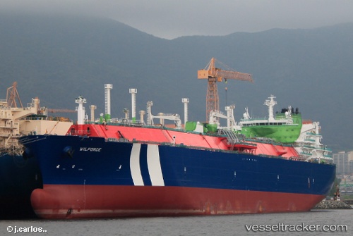
 WILFORCE
Current Status
Where is the vessel?
WILFORCE is currently in 259 nm E of Port Irene, based on AIS data received about 10h ago.
Latest AIS update:
Current position: 19.40942° N, 126.52542° E (259 nm E of Port Irene)
Average speed (last 7 days): Loading…
Average speed (last 30 days): Loading…
Vessel profile: WILFORCE is a Lng Tanker with dimensions m x m.
This page combines live AIS, route history, probable destination signals, nearby traffic, and port activity for practical vessel monitoring.
The current position of vessel WILFORCE is 19.40942 lat / 126.52542 lng. Updated: 2026-03-26 18:04:03 UTCCurrently sailing under the flag of Malta ![]()
Details:
Live Vessel WILFORCE Analytics (details, animations, etc.)
Recent AIS points (UTC):
2026-03-26 16:02:38 UTC · 18.97198, 126.53905 · SOG 13.3 kn · COG -1°2026-03-26 17:17:38 UTC · 19.25469, 126.53320 · SOG 13.1 kn · COG -1°
2026-03-26 18:04:03 UTC · 19.40942, 126.52542 · SOG 13.1 kn · COG -1°
2026-03-26 18:04:03 UTC · 19.40942, 126.52542 · SOG 13.1 kn · COG -1°