 vesseltracker.com
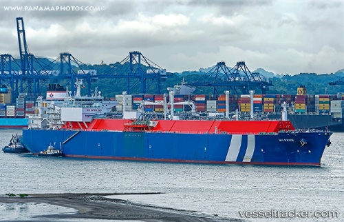
 WILPRIDE
Current Status
Where is the vessel?
WILPRIDE is currently in 41 nm W of Bnei Darom, based on AIS data received less than 1h ago.
Latest AIS update:
Current position: 32.04933° N, 30.91649° E (41 nm W of Bnei Darom)
Average speed (last 7 days): Loading…
Average speed (last 30 days): Loading…
Vessel profile: WILPRIDE is a Lng Tanker with dimensions m x m.
This page combines live AIS, route history, probable destination signals, nearby traffic, and port activity for practical vessel monitoring.
The current position of vessel WILPRIDE is 32.04933 lat / 30.91649 lng. Updated: 2026-04-19 10:19:56 UTCNearest reference points:
- Near Damietta
- 21 nm N of Port Said
- Near Alexandria
Currently sailing under the flag of Malta ![]()
Details:
Live Vessel WILPRIDE Analytics (details, animations, etc.)
Recent AIS points (UTC):
2026-04-19 05:57:25 UTC · 31.50039, 31.76110 · SOG 6.9 kn · COG 11°2026-04-19 07:28:02 UTC · 31.78402, 31.64883 · SOG 14.3 kn · COG 296°
2026-04-19 09:44:00 UTC · 32.00587, 31.07621 · SOG 13.8 kn · COG -1°
2026-04-19 10:19:56 UTC · 32.04933, 30.91649 · SOG 14.5 kn · COG 282°