 vesseltracker.com
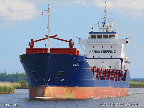
 Kaili
Kaili
Current Status
Where is the vessel?
Kaili is currently in Near Hamburg-Mitte, based on AIS data received about 616d ago.
Latest AIS update:
Current position: 53.53269° N, 9.98825° E (Near Hamburg-Mitte)
Average speed (last 7 days): Loading…
Average speed (last 30 days): Loading…
Vessel profile: Kaili is a General Cargo Ship with dimensions 100m x 99m.
This page combines live AIS, route history, probable destination signals, nearby traffic, and port activity for practical vessel monitoring.
The current position of vessel Kaili is 53.53269 lat / 9.98825 lng. Updated: 2024-08-14 07:00:07 UTCNearest reference points:
- Near Hamburg-Mitte
- Near Bahrenfeld
- Near Allermöhe
Currently sailing under the flag of Malta ![]()
Kaili built in 1996 year
Deadweight:
4512 tDetails:
Live Vessel Kaili Analytics (details, animations, etc.)
Recent AIS points (UTC):
2024-08-14 07:00:07 UTC · 53.53269, 9.98825 · SOG 0 kn · COG 183°