 vesseltracker.com
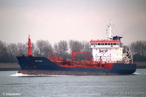
 ABILITY
Current Status
Where is the vessel?
ABILITY is currently in Near ALIMOS, based on AIS data received about 8h ago.
Latest AIS update:
Current position: 37.91111° N, 23.70393° E (Near ALIMOS)
Average speed (last 7 days): Loading…
Average speed (last 30 days): Loading…
Vessel profile: ABILITY is a Oil/Chemical Tanker with dimensions m x m.
This page combines live AIS, route history, probable destination signals, nearby traffic, and port activity for practical vessel monitoring.
The current position of vessel ABILITY is 37.91111 lat / 23.70393 lng. Updated: 2026-03-27 02:24:49 UTCNearest reference points:
- Near ALIMOS
- Near FLISVOS
- Near ZEA
Currently sailing under the flag of Malta ![]()
Details:
Live Vessel ABILITY Analytics (details, animations, etc.)
Recent AIS points (UTC):
2026-03-27 01:37:06 UTC · 37.91109, 23.70364 · SOG 0.6 kn · COG -1°2026-03-27 02:24:49 UTC · 37.91111, 23.70393 · SOG 0.2 kn · COG -1°
2026-03-27 02:24:49 UTC · 37.91111, 23.70393 · SOG 0.2 kn · COG -1°
2026-03-27 02:24:49 UTC · 37.91111, 23.70393 · SOG 0.2 kn · COG -1°