 vesseltracker.com
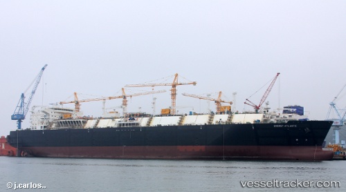
 Energy Atlantic
Current Status
Where is the vessel?
Energy Atlantic is currently in 215 nm N of Tinaquillo, based on AIS data received about 1h ago.
Latest AIS update:
Current position: 13.49594° N, 68.53024° E (215 nm N of Tinaquillo)
Average speed (last 7 days): Loading…
Average speed (last 30 days): Loading…
Vessel profile: Energy Atlantic is a Lng Tanker with dimensions 290m x 290m.
This page combines live AIS, route history, probable destination signals, nearby traffic, and port activity for practical vessel monitoring.
The current position of vessel Energy Atlantic is 13.49594 lat / 68.53024 lng. Updated: 2026-03-29 00:53:12 UTCNearest reference points:
- 198 nm N of Tinaquillo
- 187 nm N of Tinaquillo
- 202 nm NW of Amini Island
Currently sailing under the flag of Malta ![]()
Details:
Live Vessel Energy Atlantic Analytics (details, animations, etc.)
Recent AIS points (UTC):
2026-03-28 20:20:36 UTC · 14.44741, 67.63177 · SOG 17.3 kn · COG 137°2026-03-28 21:32:05 UTC · 14.19392, 67.86646 · SOG 17 kn · COG 137°
2026-03-28 23:32:44 UTC · 13.76483, 68.25839 · SOG 17.1 kn · COG -1°
2026-03-29 00:53:12 UTC · 13.49594, 68.53024 · SOG 16.7 kn · COG 137°