 vesseltracker.com
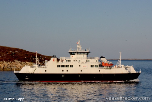
 Luroey
Current Status
Where is the vessel?
Luroey is currently in Near Lovund, based on AIS data received less than 1h ago.
Latest AIS update:
Current position: 66.36908° N, 12.37087° E (Near Lovund)
Average speed (last 7 days): Loading…
Average speed (last 30 days): Loading…
Vessel profile: Luroey is a Passenger Ro Ro Cargo Ship with dimensions 73m x 13m.
This page combines live AIS, route history, probable destination signals, nearby traffic, and port activity for practical vessel monitoring.
The current position of vessel Luroey is 66.36908 lat / 12.37087 lng. Updated: 2026-04-16 23:23:26 UTCNearest reference points:
- Near STRAUMOYVALEN
- Near Træna
- Near Lurøy
Currently sailing under the flag of Norway ![]()
Details:
Live Vessel Luroey Analytics (details, animations, etc.)
Recent AIS points (UTC):
2026-04-16 16:19:56 UTC · 66.38280, 12.71510 · SOG 12.1 kn · COG 95°2026-04-16 20:15:27 UTC · 66.41200, 12.57280 · SOG 11.7 kn · COG 113°
2026-04-16 21:56:58 UTC · 66.37213, 12.81172 · SOG 12.4 kn · COG 328°
2026-04-16 23:23:26 UTC · 66.36908, 12.37087 · SOG 0 kn · COG 219°