 vesseltracker.com
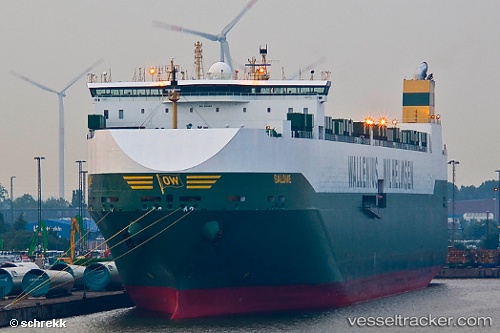
 SALOME
Current Status
Where is the vessel?
SALOME is currently in 390 nm S of Flying Fish Cove, based on AIS data received less than 1h ago.
Latest AIS update:
Current position: 16.45332° S, 108.20264° E (390 nm S of Flying Fish Cove)
Average speed (last 7 days): Loading…
Average speed (last 30 days): Loading…
Vessel profile: SALOME is a Vehicles Carrier with dimensions m x m.
This page combines live AIS, route history, probable destination signals, nearby traffic, and port activity for practical vessel monitoring.
The current position of vessel SALOME is -16.45332 lat / 108.20264 lng. Updated: 2026-04-19 12:04:53 UTCNearest reference points:
- Open sea, approx. 400 nm off the nearest listed port
- Open sea, approx. 402 nm off the nearest listed port
- Open sea, approx. 403 nm off the nearest listed port
Currently sailing under the flag of Norway ![]()
Details:
Live Vessel SALOME Analytics (details, animations, etc.)
Recent AIS points (UTC):
2026-04-19 08:18:52 UTC · -17.23070, 108.47040 · SOG 13 kn · COG 343°2026-04-19 10:06:31 UTC · -16.85833, 108.34167 · SOG 12 kn · COG -1°
2026-04-19 10:18:29 UTC · -16.81667, 108.32833 · SOG 12 kn · COG -1°
2026-04-19 12:04:53 UTC · -16.45332, 108.20264 · SOG 12.9 kn · COG 342°