 vesseltracker.com
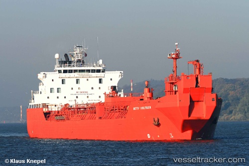
 Betty Knutsen
Current Status
Where is the vessel?
Betty Knutsen is currently in 32 nm NE of Craven Arms, based on AIS data received about 320d ago.
Latest AIS update:
Current position: 52.85667° N, 3.35917° E (32 nm NE of Craven Arms)
Average speed (last 7 days): Loading…
Average speed (last 30 days): Loading…
Vessel profile: Betty Knutsen is a Crude Oil Tanker with dimensions 187m x 27m.
This page combines live AIS, route history, probable destination signals, nearby traffic, and port activity for practical vessel monitoring.
The current position of vessel Betty Knutsen is 52.85667 lat / 3.35917 lng. Updated: 2025-05-14 07:02:23 UTCNearest reference points:
- Near Craven Arms
- 23 nm N of de Ruyter
- 22 nm W of Schoorl
Currently sailing under the flag of Norway ![]()
Betty Knutsen built in 1999 year
Deadweight:
35807 tDetails:
Live Vessel Betty Knutsen Analytics (details, animations, etc.)
Recent AIS points (UTC):
2025-05-14 07:02:23 UTC · 52.85667, 3.35917 · SOG 13.2 kn · COG 346°