 vesseltracker.com
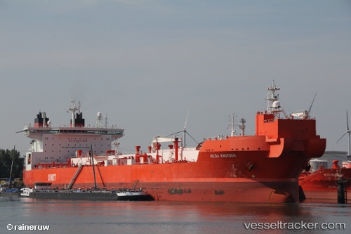
 Hilda Knutsen
Current Status
Where is the vessel?
Hilda Knutsen is currently in 45 nm W of Njord, based on AIS data received about 13h ago.
Latest AIS update:
Current position: 64.33169° N, 5.46856° E (45 nm W of Njord)
Average speed (last 7 days): Loading…
Average speed (last 30 days): Loading…
Vessel profile: Hilda Knutsen is a Crude Oil Tanker with dimensions 276m x 46m.
This page combines live AIS, route history, probable destination signals, nearby traffic, and port activity for practical vessel monitoring.
The current position of vessel Hilda Knutsen is 64.33169 lat / 5.46856 lng. Updated: 2026-04-10 06:19:35 UTCNearest reference points:
- Near Gjøsundet
- Near Brattvåg
- Near Alesund
Currently sailing under the flag of Norway ![]()
Hilda Knutsen built in 2013 year
Deadweight:
123166 tDetails:
Live Vessel Hilda Knutsen Analytics (details, animations, etc.)
Recent AIS points (UTC):
2026-04-10 01:56:30 UTC · 64.81681, 6.38710 · SOG 8 kn · COG -1°2026-04-10 03:49:58 UTC · 64.61726, 6.01048 · SOG 8.6 kn · COG 222°
2026-04-10 05:21:49 UTC · 64.44203, 5.67749 · SOG 8.9 kn · COG 217°
2026-04-10 06:19:35 UTC · 64.33169, 5.46856 · SOG 9.4 kn · COG 205°