 vesseltracker.com
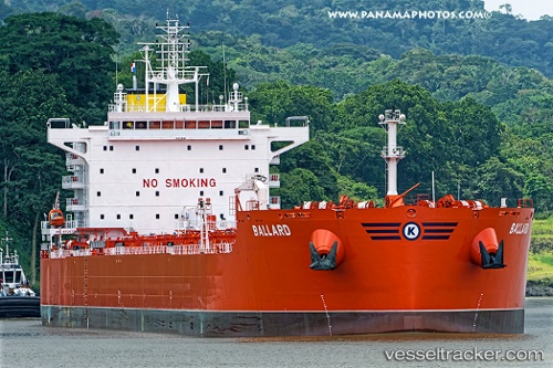
 BALLARD
Current Status
Where is the vessel?
BALLARD is currently in Near Glen Iris, based on AIS data received less than 1h ago.
Latest AIS update:
Current position: 33.32078° S, 115.66442° E (Near Glen Iris)
Average speed (last 7 days): Loading…
Average speed (last 30 days): Loading…
Vessel profile: BALLARD is a Tanker B with dimensions m x m.
This page combines live AIS, route history, probable destination signals, nearby traffic, and port activity for practical vessel monitoring.
The current position of vessel BALLARD is -33.32078 lat / 115.66442 lng. Updated: 2026-04-13 07:23:07 UTCNearest reference points:
- Near Bunbury
- Near Kwinana
- Near Fremantle
Currently sailing under the flag of Norway ![]()
Details:
Live Vessel BALLARD Analytics (details, animations, etc.)
Recent AIS points (UTC):
2026-04-13 02:01:02 UTC · -33.25280, 115.61510 · SOG 8.4 kn · COG 135°2026-04-13 04:20:08 UTC · -33.32078, 115.66443 · SOG 0 kn · COG 314°
2026-04-13 05:29:07 UTC · -33.32078, 115.66443 · SOG 0 kn · COG 315°
2026-04-13 07:23:07 UTC · -33.32078, 115.66442 · SOG 0 kn · COG 315°