 vesseltracker.com
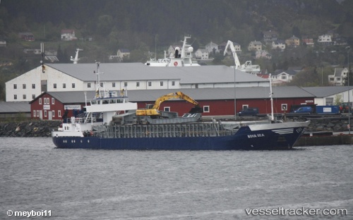
 Bona Sea
Current Status
Where is the vessel?
Bona Sea is currently in Near Gjøsundet, based on AIS data received about 1h ago.
Latest AIS update:
Current position: 62.52977° N, 6.12175° E (Near Gjøsundet)
Average speed (last 7 days): Loading…
Average speed (last 30 days): Loading…
Vessel profile: Bona Sea is a Multi Purpose Carrier with dimensions 74m x 12m.
This page combines live AIS, route history, probable destination signals, nearby traffic, and port activity for practical vessel monitoring.
The current position of vessel Bona Sea is 62.52977 lat / 6.12175 lng. Updated: 2026-04-22 14:09:00 UTCNearest reference points:
- Near Gjøsundet
- Near Alesund
- Near Fiskarstrand
Currently sailing under the flag of Norway ![]()
Bona Sea built in 1986 year
Deadweight:
1505 tDetails:
Live Vessel Bona Sea Analytics (details, animations, etc.)
Recent AIS points (UTC):
2026-04-22 10:42:58 UTC · 62.52977, 6.12176 · SOG 0 kn · COG 313°2026-04-22 12:19:48 UTC · 62.52977, 6.12178 · SOG 0 kn · COG 312°
2026-04-22 13:38:19 UTC · 62.52978, 6.12175 · SOG 0 kn · COG 314°
2026-04-22 14:09:00 UTC · 62.52977, 6.12175 · SOG 0 kn · COG 312°