 vesseltracker.com
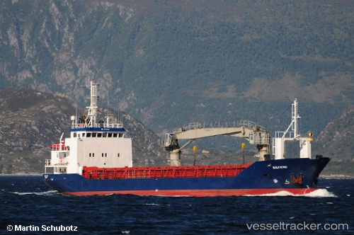
 Gullaas
Current Status
Where is the vessel?
Gullaas is currently in Near Dolmøy, based on AIS data received about 1h ago.
Latest AIS update:
Current position: 63.63843° N, 8.80521° E (Near Dolmøy)
Average speed (last 7 days): Loading…
Average speed (last 30 days): Loading…
Vessel profile: Gullaas is a Deck Cargo Ship with dimensions 67m x 11m.
This page combines live AIS, route history, probable destination signals, nearby traffic, and port activity for practical vessel monitoring.
The current position of vessel Gullaas is 63.63843 lat / 8.80521 lng. Updated: 2026-04-21 06:20:51 UTCNearest reference points:
- Near Dolmøy
- Near Siholmen
- Near Dyrvik
Currently sailing under the flag of Norway ![]()
Gullaas built in 1987 year
Deadweight:
1218 tDetails:
Live Vessel Gullaas Analytics (details, animations, etc.)
Recent AIS points (UTC):
2026-04-21 01:44:00 UTC · 63.63843, 8.80516 · SOG 0 kn · COG 62°2026-04-21 03:30:41 UTC · 63.63841, 8.80516 · SOG 0 kn · COG 62°
2026-04-21 04:15:09 UTC · 63.63841, 8.80520 · SOG 0 kn · COG 62°
2026-04-21 06:20:51 UTC · 63.63843, 8.80521 · SOG 0 kn · COG 62°