 vesseltracker.com
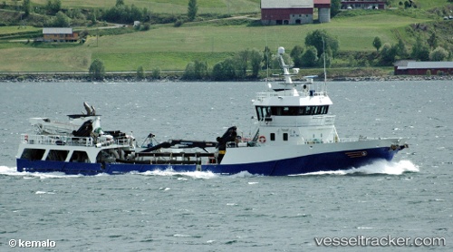
 Langsund
Current Status
Where is the vessel?
Langsund is currently in Near Vikan - Smøla, based on AIS data received less than 1h ago.
Latest AIS update:
Current position: 63.33028° N, 8.31092° E (Near Vikan - Smøla)
Average speed (last 7 days): Loading…
Average speed (last 30 days): Loading…
Vessel profile: Langsund is a Fish Carrier with dimensions 58m x 10m.
This page combines live AIS, route history, probable destination signals, nearby traffic, and port activity for practical vessel monitoring.
The current position of vessel Langsund is 63.33028 lat / 8.31092 lng. Updated: 2026-04-23 01:09:27 UTCNearest reference points:
- Near Halsa
- Near Kristiansund
- Near Smøla
Currently sailing under the flag of Norway ![]()
Langsund built in 2001 year
Deadweight:
650 tDetails:
Live Vessel Langsund Analytics (details, animations, etc.)
Recent AIS points (UTC):
2026-04-22 21:45:47 UTC · 63.06678, 7.37167 · SOG 9.6 kn · COG 63°2026-04-22 22:04:08 UTC · 63.08463, 7.47265 · SOG 9.6 kn · COG 52°
2026-04-23 00:16:27 UTC · 63.26007, 8.09390 · SOG 8 kn · COG 67°
2026-04-23 01:09:27 UTC · 63.33028, 8.31092 · SOG 8.2 kn · COG 47°