 vesseltracker.com
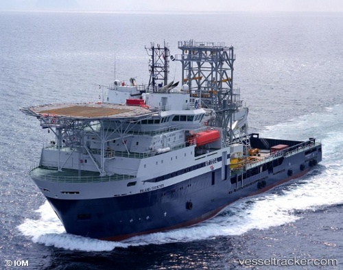
Island Frontier
Current StatusWhere is the vessel?
Island Frontier is currently in 87 nm S of Gulfmex Lightering Area, based on AIS data received about 1h ago.
Latest AIS update:
Current position: 26.30155° N, 90.99826° W (87 nm S of Gulfmex Lightering Area)
Average speed (last 7 days): Loading…
Average speed (last 30 days): Loading…
Vessel profile: Island Frontier is a Well Stimulation Vessel with dimensions 21m x 106m.
This page combines live AIS, route history, probable destination signals, nearby traffic, and port activity for practical vessel monitoring.
The current position of vessel Island Frontier is 26.30155 lat / -90.99826 lng. Updated: 2026-04-01 15:56:53 UTCNearest reference points:
- 94 nm S of Gulfmex Lightering Area
- 124 nm SW of Gulfmex Lightering Area
- 83 nm W of Gulfmex Lightering Area
Details:
Live Vessel Island Frontier Analytics (details, animations, etc.)
Recent AIS points (UTC):
2026-04-01 08:45:50 UTC · 26.21782, -91.00016 · SOG 1 kn · COG -1°2026-04-01 12:16:05 UTC · 26.27956, -90.99939 · SOG 1 kn · COG -1°
2026-04-01 14:16:42 UTC · 26.30172, -90.99860 · SOG 0.1 kn · COG -1°
2026-04-01 15:56:53 UTC · 26.30155, -90.99826 · SOG 0 kn · COG -1°