 vesseltracker.com
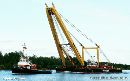
 TRONDS LIFT 8
Current Status
Where is the vessel?
TRONDS LIFT 8 is currently in Near DUSANIK, based on AIS data received about 1h ago.
Latest AIS update:
Current position: 58.99890° N, 5.66869° E (Near DUSANIK)
Average speed (last 7 days): Loading…
Average speed (last 30 days): Loading…
Vessel profile: TRONDS LIFT 8 is a Floating Sheerleg with dimensions m x m.
This page combines live AIS, route history, probable destination signals, nearby traffic, and port activity for practical vessel monitoring.
The current position of vessel TRONDS LIFT 8 is 58.99890 lat / 5.66869 lng. Updated: 2026-04-20 20:03:02 UTCNearest reference points:
- Near Lura
- Near HUSOYA
- Near Storøya
Currently sailing under the flag of Norway ![]()
Details:
Live Vessel TRONDS LIFT 8 Analytics (details, animations, etc.)
Recent AIS points (UTC):
2026-04-20 17:03:41 UTC · 58.99891, 5.66864 · SOG 0 kn · COG -1°2026-04-20 17:57:32 UTC · 58.99889, 5.66858 · SOG 0 kn · COG -1°
2026-04-20 19:57:52 UTC · 58.99890, 5.66861 · SOG 0 kn · COG -1°
2026-04-20 20:03:02 UTC · 58.99890, 5.66869 · SOG 0 kn · COG -1°