 vesseltracker.com
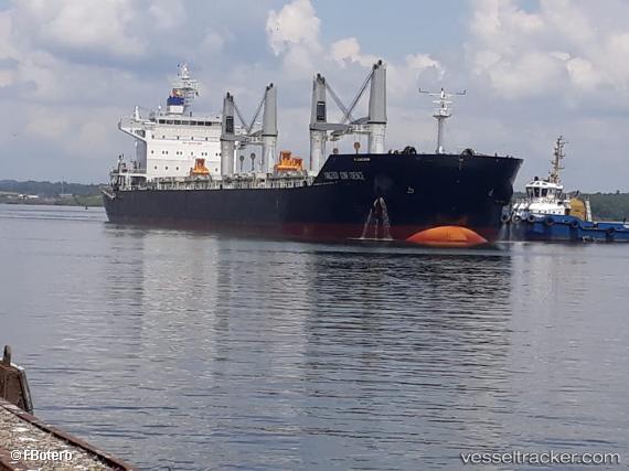
 SPAR NORMA
Current Status
Where is the vessel?
SPAR NORMA is currently in Near Puerto San José, based on AIS data received less than 1h ago.
Latest AIS update:
Current position: 13.87833° N, 90.79500° W (Near Puerto San José)
Average speed (last 7 days): Loading…
Average speed (last 30 days): Loading…
Vessel profile: SPAR NORMA is a Bulk Carrier with dimensions 32m x 199m.
This page combines live AIS, route history, probable destination signals, nearby traffic, and port activity for practical vessel monitoring.
The current position of vessel SPAR NORMA is 13.87833 lat / -90.79500 lng. Updated: 2026-04-05 23:25:36 UTCNearest reference points:
- Near San Jose
Currently sailing under the flag of Norway (NIS) ![]()
SPAR NORMA built in 2017 year
Deadweight:
63165 tDetails:
Live Vessel SPAR NORMA Analytics (details, animations, etc.)
Recent AIS points (UTC):
2026-04-05 17:34:15 UTC · 13.87954, -90.79525 · SOG 0.5 kn · COG 246°2026-04-05 19:55:15 UTC · 13.87989, -90.79526 · SOG 0.5 kn · COG 240°
2026-04-05 22:04:15 UTC · 13.87914, -90.79490 · SOG 0.4 kn · COG 265°
2026-04-05 23:25:36 UTC · 13.87833, -90.79500 · SOG 0 kn · COG -1°