 vesseltracker.com
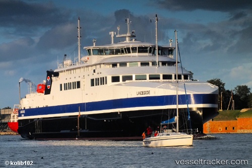
 Landegode
Current Status
Where is the vessel?
Landegode is currently in Near Værøy, based on AIS data received less than 1h ago.
Latest AIS update:
Current position: 67.55573° N, 12.53947° E (Near Værøy)
Average speed (last 7 days): Loading…
Average speed (last 30 days): Loading…
Vessel profile: Landegode is a Passenger Ro Ro Cargo Ship with dimensions 96m x 17m.
This page combines live AIS, route history, probable destination signals, nearby traffic, and port activity for practical vessel monitoring.
The current position of vessel Landegode is 67.55573 lat / 12.53947 lng. Updated: 2026-04-19 16:46:27 UTCNearest reference points:
- Near VAEROY
- Near ROST
- Near Ørnes
Currently sailing under the flag of Norway ![]()
Landegode built in 2012 year
Deadweight:
650 tDetails:
Live Vessel Landegode Analytics (details, animations, etc.)
Recent AIS points (UTC):
2026-04-19 13:58:47 UTC · 67.88169, 13.06375 · SOG 17 kn · COG 322°2026-04-19 14:00:04 UTC · 67.88643, 13.05433 · SOG 15.6 kn · COG 328°
2026-04-19 16:21:46 UTC · 67.63869, 12.72236 · SOG 15.7 kn · COG 164°
2026-04-19 16:46:27 UTC · 67.55573, 12.53947 · SOG 16.1 kn · COG 232°