 vesseltracker.com
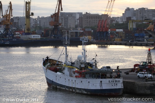
Ilha Brava
Current StatusWhere is the vessel?
Ilha Brava is currently in 286 nm SE of LA PALOMA, based on AIS data received less than 1h ago.
Latest AIS update:
Current position: 37.95932° S, 49.88005° W (286 nm SE of LA PALOMA)
Average speed (last 7 days): Loading…
Average speed (last 30 days): Loading…
Vessel profile: Ilha Brava is a Fishing Vessel with dimensions 8m x 45m.
This page combines live AIS, route history, probable destination signals, nearby traffic, and port activity for practical vessel monitoring.
The current position of vessel Ilha Brava is -37.95932 lat / -49.88005 lng. Updated: 2026-04-02 11:30:15 UTCNearest reference points:
- Open sea, approx. 420 nm off the nearest listed port
- Open sea, approx. 421 nm off the nearest listed port
- Open sea, approx. 434 nm off the nearest listed port
Details:
Live Vessel Ilha Brava Analytics (details, animations, etc.)
Recent AIS points (UTC):
2026-04-02 05:26:10 UTC · -37.98638, -49.88022 · SOG 1.8 kn · COG -1°2026-04-02 07:17:30 UTC · -37.99188, -49.89682 · SOG 0.5 kn · COG -1°
2026-04-02 10:15:19 UTC · -37.95878, -49.68587 · SOG 1.5 kn · COG -1°
2026-04-02 11:30:15 UTC · -37.95932, -49.88005 · SOG 9.5 kn · COG -1°