 vesseltracker.com
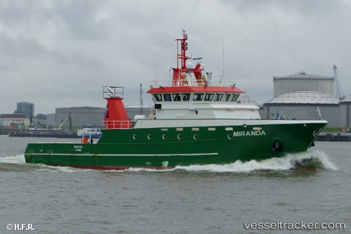
 MIRANDA
Current Status
Where is the vessel?
MIRANDA is currently in Near Llanwrda, based on AIS data received less than 1h ago.
Latest AIS update:
Current position: 51.96586° N, 3.81074° E (Near Llanwrda)
Average speed (last 7 days): Loading…
Average speed (last 30 days): Loading…
Vessel profile: MIRANDA is a Other Type with dimensions m x m.
This page combines live AIS, route history, probable destination signals, nearby traffic, and port activity for practical vessel monitoring.
The current position of vessel MIRANDA is 51.96586 lat / 3.81074 lng. Updated: 2026-04-23 00:14:29 UTCNearest reference points:
- Near Haarlemmermeer
- Near MAASVLAKTE - ROTTERDAM
- Near DEN OSSE
Currently sailing under the flag of San Marino ![]()
Details:
Live Vessel MIRANDA Analytics (details, animations, etc.)
Recent AIS points (UTC):
2026-04-22 20:02:26 UTC · 52.11614, 3.96469 · SOG 9.2 kn · COG 232°2026-04-22 21:45:04 UTC · 51.96760, 3.82996 · SOG 4.4 kn · COG 277°
2026-04-22 22:03:29 UTC · 51.96552, 3.79182 · SOG 4.6 kn · COG 279°
2026-04-23 00:14:29 UTC · 51.96586, 3.81074 · SOG 4.6 kn · COG 66°