 vesseltracker.com
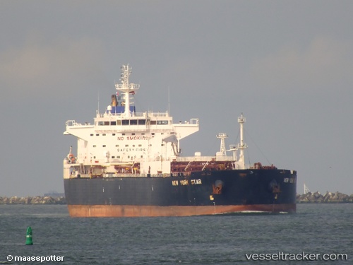
 KESTREL
Current Status
Where is the vessel?
KESTREL is currently in 31 nm W of Belanak Terminal, based on AIS data received about 1h ago.
Latest AIS update:
Current position: 4.11298° N, 105.71644° E (31 nm W of Belanak Terminal)
Average speed (last 7 days): Loading…
Average speed (last 30 days): Loading…
Vessel profile: KESTREL is a Crude Oil Tanker with dimensions m x m.
This page combines live AIS, route history, probable destination signals, nearby traffic, and port activity for practical vessel monitoring.
The current position of vessel KESTREL is 4.11298 lat / 105.71644 lng. Updated: 2026-04-20 02:02:38 UTCNearest reference points:
- 26 nm E of Belida Terminal
- 30 nm SW of Belanak Terminal
- 39 nm SE of Belida Terminal
Currently sailing under the flag of San Marino ![]()
Details:
Live Vessel KESTREL Analytics (details, animations, etc.)
Recent AIS points (UTC):
2026-04-19 22:54:17 UTC · 3.49527, 105.38265 · SOG 13.4 kn · COG 28°2026-04-19 23:57:48 UTC · 3.70142, 105.49392 · SOG 13.3 kn · COG 28°
2026-04-20 02:00:27 UTC · 4.10915, 105.71420 · SOG 13.5 kn · COG 30°
2026-04-20 02:02:38 UTC · 4.11298, 105.71644 · SOG 13.7 kn · COG 30°