 vesseltracker.com
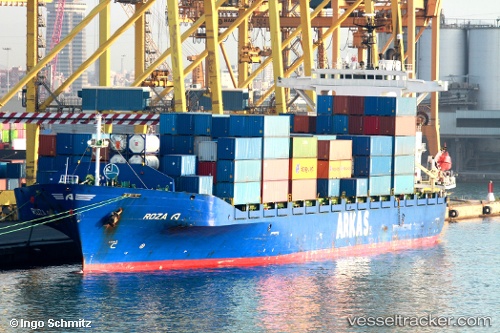
Vessel Roza A IMO: 9126742, MMSI: 271001057 Container Ship
UTC, 41.49798, 28.89478, course: 195, speed: 5.8
UTC, 41.45545, 28.88741, course: 126, speed: 0.9
2026-03-14 05:46:48 UTC, 41.41972, 28.89288, course: 108, speed: 1.1
Live Vessel Roza A Analytics (details, animations, etc.)
Live AIS position: UTC. 11 nm NE of Istanbul New Airport), updated 2026-03-14 05:46:48 UTC.Find the position of the vessel Roza A on the map. The latter are known coordinates and path.
marine traffic ship tracker show on live map
The current position of vessel Roza A is 41.41972 lat / 28.89288 lng. Updated: 2026-03-14 05:46:48 UTCCurrently sailing under the flag of Turkey
Roza A built in 1997 year
Deadweight:
19325 tDetails:
Last coordinates of the vessel:
UTC, 41.88280, 28.57070, course: 144, speed: 14.4UTC, 41.49798, 28.89478, course: 195, speed: 5.8
UTC, 41.45545, 28.88741, course: 126, speed: 0.9
2026-03-14 05:46:48 UTC, 41.41972, 28.89288, course: 108, speed: 1.1